 Image 1 of 5
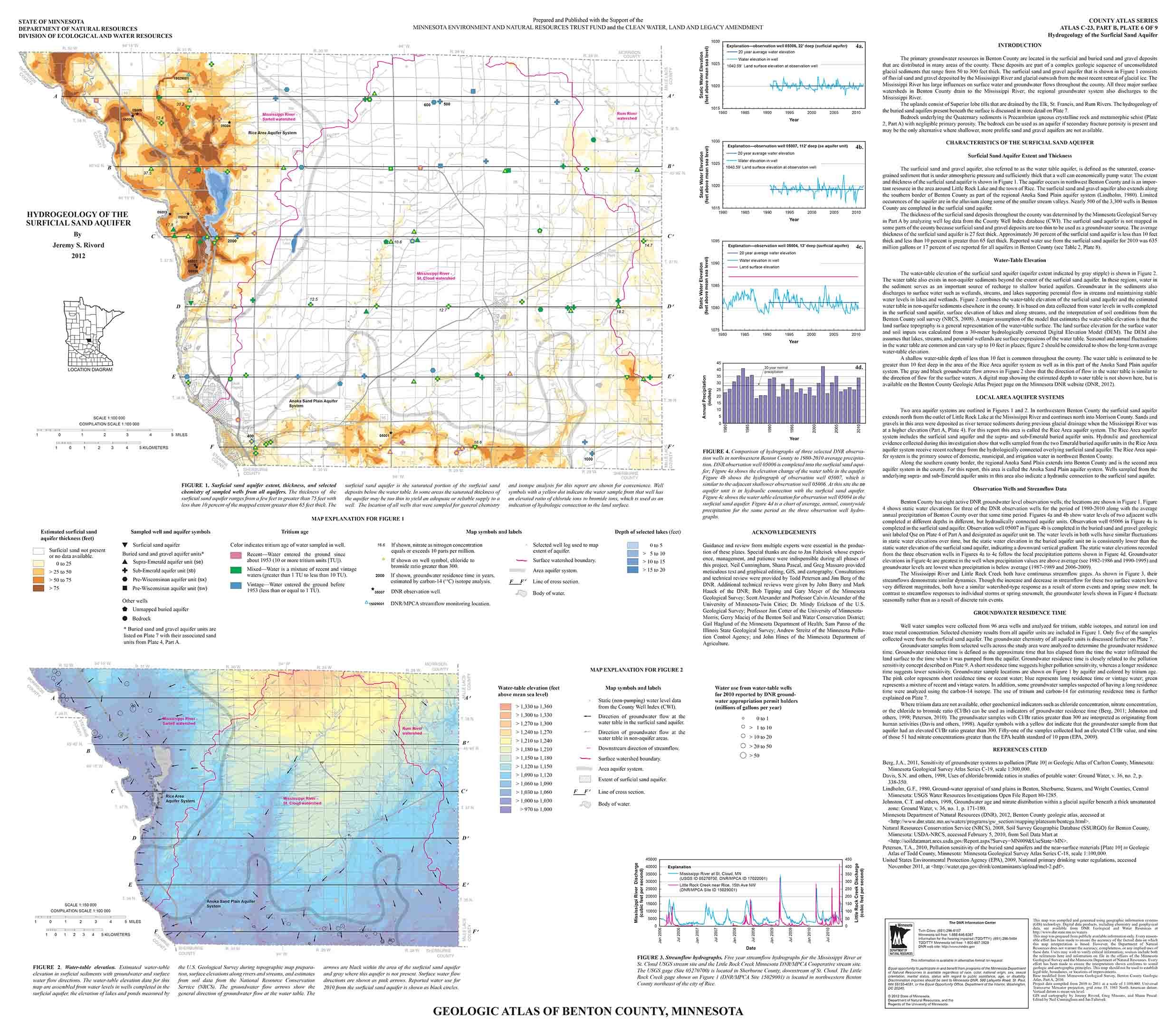 Image 2 of 5
 Image 3 of 5
 Image 4 of 5
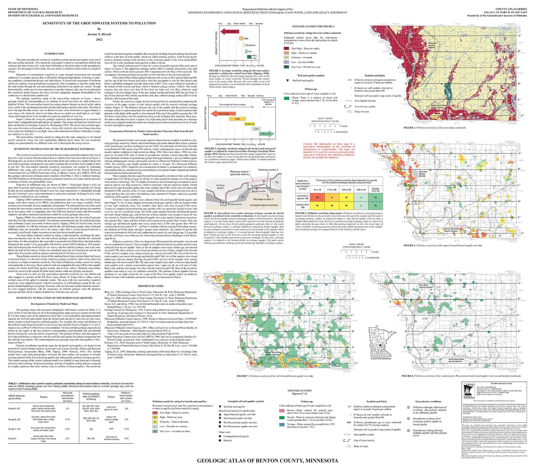 Image 5 of 5
The atlas includes the following pieces, printed by OceanGrafix. Atlas contents:
Part B Groundwater/Hydrogeology: 2012
Plate 6 - Hydrogeology of the Surficial Sand Aquifer 33x29
Plate 7 - Hydrogeologic Cross Sections 33x29
Plate 8 - Hydrogeology of the Buried Aquifers and the Rice Area Aquifer System 33x29
Plate 9 - Sensitivity of Groundwater Systems to Pollution 33x29
The Minnesota DNR produces the Part B atlases (Groundwater), which includes plates and reports identifying the direction of groundwater flow, aquifer properties, groundwater chemistry, and pollution sensitivity of aquifers. In older atlases the groundwater information is included in Part A (Geology, published by the Minnesota Geological Survey). See the Groundwater Atlas User Guide (PDF) for an overview of reading Part B (8 pages) and digital versions of the atlases at mndnr.gov/groundwatermapping.